karta, falsad., 2017, Engelska, ISBN 9781846239236
Plans included:Stretto di Messina (1:125 000)On this 2017 edition the two new Traffic Separation Schemes off the Algerian coast are shown. The chart specification has been improved …
karta, falsad., 2014, Engelska, ISBN 9781846236167
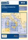
Plans included: Monte Argentario (1:100 000) Bonifacio Strait (1:225 000) Golfo di Salerno (1:100 000) For this 2014 edition the chart has been fully updated throughout using …
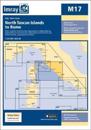
On this 2017 the latest known depths have been applied. Harbour developments at Civitavecchia and Fiumicino are included as is the restricted area on the approach to Anzio. The …