karta, falsad., 2018, Engelska, ISBN 9783707916881
freytagberndt maps are available for many countries and regions in the world. In addition to the precise cartography each map also includes a lot of additional information about …
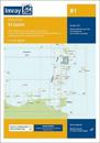
Imray-Iolaire charts for the Caribbean are widely acknowledged as the best available for the cruising sailor. They combine the latest official survey data with first-hand …
Imray-Iolaire charts for the Caribbean are widely acknowledged as the best available for the cruising sailor. They combine the latest official survey data with first-hand …
Plans included: Rodney Bay and Yacht Harbour (1:25 000) Port Castries (1:12 500) Grand Cul de Sac Bay (1:15 000) Marigot Harbour (1:7500) Soufriere Bay and The Pitons (1:40 000) …
karta, falsad., 2019, Engelska, ISBN 9781786791467
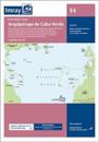
On this edition the chart specification has been improved to show coloured light flashes. Depths have been updated from the latest available surveys where available. Completed …
karta, falsad., 2015, Engelska, ISBN 9781597756181
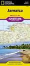
National Geographic Adventure Maps are the most authoritative maps for touring international destinations. Each waterproof and tear-resistant map provides travellers with the …