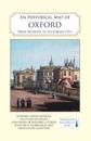
karta, falsad., 2021, Engelska, ISBN 9780993469893
A full colour map, based on a digitised map of the city of Oxford in 1876, with its medieval past overlain and important buildings picked out. The map's cover has a short …
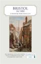
karta, falsad., 2021, Engelska, ISBN 9780993469879
A full colour map, where the city in about 1480 is shown against a background of a detailed Ordnance Survey of the early 20th century. Produced in association with the University …
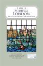
karta, falsad., 2019, Engelska, ISBN 9780993469855
A full colour map showing London about 1270 to 1300 - its walls and gates, parish churches, early monasteries and hospitals, and a growing number of private houses. The city's …
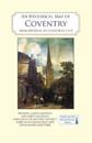
karta, falsad., 2020, Engelska, ISBN 9780993469862
Coventry is UK City of Culture, 2021. A full colour map, based on a digitised map of the city of Coventry in 1913, with its medieval past overlain and important buildings picked …
karta, falsad., 2021, Engelska, ISBN 9780993469886
A full colour map, based on a digitised map of the city of Canterbury in 1907, with its Roman, Anglo-Saxon and medieval past overlain and important buildings picked out. The map's …