Imray-Tetra charts for the Ionian and Aegean are widely acknowledged as the best available for the cruising sailor. They combine the latest official survey data with first-hand …
Plans included: Marina Alimos (Kalamáki) (1:12 500) Stenón Metópis (1:30 000) Limín Póros (1:25 000) Nisídhes Tselevínia (1:50 000) Stenón Spétsai (1:40 000) Návplion (1:20 000) …
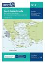
Plans included: Approaches to Kós (Nísos Kós) (1:20 000) Approaches to Turgutreis (Turkey) (1:100 000) Bodrum (Turkey) (1:20 000) Approaches to Ródhos (Nísos Ródhos) (1:30 000) …
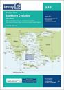
Plans included: Stenón Kimólou-Políagou and Stenón Mílou-Kimólou (1:40 000) Órmos Náxou (N. Náxos) (1:20 000) Órmos Livádhiou (N. Sérifos) (1:15 000) Stenón Andipárou (1:40 000) …