karta, falsad., 2023, Engelska, ISBN 9780008581794
Clear and easy-to-read map of central London and surrounding area. Contains detailed mapping, presented in a handy compact format. This attractive map, ideal for both tourists and …
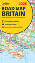
karta, falsad., 2024, Engelska, ISBN 9780008652913
Explore Britain with easy-to-read mapping from Collins. Full-colour, double-sided road map of Great Britain at a scale of 8.7 miles to 1 inch. Northern England, Scotland …
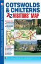
karta, falsad., 2014, Engelska, ISBN 9781782570332
This map of the Cotswolds & Chilterns is a full colour visitors' map featuring road mapping that covers an area extending to:•Worcester•Royal Leamington …
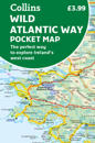
karta, falsad., 2023, Engelska, ISBN 9780008580001
Explore new places with handy pocket maps from Collins. Handy full-colour map of Ireland’s Wild Atlantic Way with a high level of detail. Clear mapping of the full 2500 …
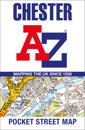
karta, falsad., 2024, Engelska, ISBN 9780008657451
Navigate your way around Chester with detailed street maps from A-Z This up-to-date, folded A-Z street map includes 2,600 streets in and around Brighton. As well as the …
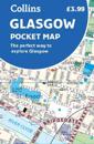
karta, falsad., 2022, Engelska, ISBN 9780008492588
Handy little full colour Collins map of central Glasgow with a high level of detail. Clear mapping from the park of Glasgow Green to the bustling West End. Map at a scale of 1:8200 …
karta, falsad., 2023, Engelska, ISBN 9780008604424
Explore the whole of Scotland from Dumfries and Galloway in the South to the Orkney Islands in the North. With detailed road mapping and illustrated town plans of major cities, …
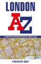
karta, falsad., 2023, Engelska, ISBN 9780008581763
Navigate your way around London with this detailed, easy-to-use, and up-to-date A-Z Premier Map. A full-colour, single sided, fold-out street map, covering a six-mile …
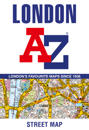
karta, falsad., 2023, Engelska, ISBN 9780008581787
This great value, fold-out map uses our instantly recognisable A-Z street mapping and has handy a TfL Tube map on the back for easy access. Published at a scale of 3.5 …
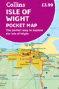
karta, falsad., 2023, Engelska, ISBN 9780008579999
Explore new places with handy pocket maps from Collins. Handy little full-colour map of the Isle of Wight. Detailed mapping and tourist information of the whole island. …