karta, falsad., 2024, Engelska, ISBN 9780008665012
Explore new places with this up-to-date map of Scotland. Best-selling map of Scotland. More than 1,000 places of tourist interest plotted and named on the map. The …
karta, falsad., 2024, Engelska, ISBN 9780008653118
Explore the whole county and area extending into Devon as far as Great Torrington, Tavistock and Plymouth. This detailed and up-to-date map contains more than 1,000 places of …
karta, falsad., 2022, Engelska, ISBN 9780008520649
Handy little full colour map of Shetland. Main features of this map include:• Clear mapping• Main tourist attractions located and described• Ideal for touring with …
karta, falsad., 2022, Engelska, ISBN 9780008520694
Explore new places with handy pocket maps from Collins. Handy little full colour map of the Cotswolds. Detailed mapping and tourist information ideal for any …
karta, falsad., 2023, Engelska, ISBN 9780008580056
Explore new places with handy pocket maps from Collins. Handy little full-colour map of the Western Isles of Scotland. Detailed mapping and tourist information for the …
karta, falsad., 2022, Engelska, ISBN 9780008492618
A new edition of London’s most original map. This hand-watercoloured map contains individual paintings of all the main sites and landmarks, shop-by-shop street maps, theatres and …
karta, falsad., 2014, Engelska, ISBN 9781782570332
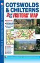
This map of the Cotswolds & Chilterns is a full colour visitors' map featuring road mapping that covers an area extending to:•Worcester•Royal Leamington …
karta, falsad., 2023, Engelska, ISBN 9780008604417
Explore the whole region of Yorkshire extending from Sheffield to Darlington. With detailed road mapping and illustrated town plans of major cities, this feature rich, helpful …
karta, falsad., 2023, Engelska, ISBN 9780008580001
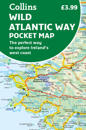
Explore new places with handy pocket maps from Collins. Handy full-colour map of Ireland’s Wild Atlantic Way with a high level of detail. Clear mapping of the full 2500 …