This book is an introduction to the use of the ultraviolet for remote sensing of the Earth's atmosphere. It covers the Earth's UV radiative environment, experimental techniques, …
Authored by one of the world's hydrocarbon exploration experts, Geophysical Exploration Technology: Applications in Lithological and Stratigraphic Reservoirs presents the latest …
Adjustment Models in 3D Geomatics and Computational Geophysics: With MATLAB Examples, Volume Four introduces a complete package of theoretical and practical subjects in adjustment …
Remote Sensing in Precision Agriculture: Transforming Scientific Advancement into Innovation compiles the latest applications of remote sensing in agriculture using spaceborne, …
Developments in the Theory and Practice of Cybercartography-awarded an Honorable Mention in Earth Science at the Association of American Publishers' 2015 PROSE Awards-examines some …
Earth Observation for Flood Applications: Progress and Perspectives describes the latest scientific advances in Earth Observation. With recent floods around the world becoming ever …
A practical book for those engaged in marine surveying and charting activities who must acquire, process and present data for hydrographic or engineering purposes. It covers the …
This book represents five and a half years of work by the ICA Commission on Standards for the Transfer of Spatial Data during the 1991- 95 ICA cycle. The effort began with the …
Remote Sensing of Geomorphology, Volume 23, discusses the new range of remote-sensing techniques (lidar, structure from motion photogrammetry, advanced satellite platforms) that …
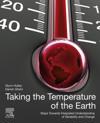
Taking the Temperature of the Earth: Steps towards Integrated Understanding of Variability and Change presents an integrated, collaborative approach to observing and understanding …