Arthur Robert Hinks (1873–1945) was a renowned British astronomer and geographer. First published in 1944, as the fifth edition of a 1913 original, this book was written by Hinks …
Originally published in 1952, this book is intended as an introductory guide to aerial mapping and photogrammetry. The main emphasis is on making maps during wartime, when accuracy …
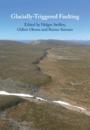
Glacially triggered faulting describes movement of pre-existing faults caused by a combination of tectonic and glacially induced isostatic stresses. The most impressive …
Glacially triggered faulting describes movement of pre-existing faults caused by a combination of tectonic and glacially induced isostatic stresses. The most impressive …
Geomathematics provides a comprehensive summary of the mathematical principles behind key topics in geophysics and geodesy, covering the foundations of gravimetry, geomagnetics and …
Written as both a textbook and a handy reference, this text deliberately avoids complex mathematics assuming only basic familiarity with geodynamic theory and calculus. Here, the …
Originally published in 1930, this book provides a general introduction to regional surveying. The text is accompanied by sample charts and drawings to illuminate some of the more …
Originally published in 1925, this book was written following a series of experiments at Cambridge regarding problems arising in the construction of maps from aerial photographs. …