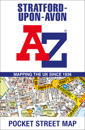
karta, falsad., 2024, Engelska, ISBN 9780008657468
Navigate your way around Stratford-upon-Avon with detailed street maps from A-Z This up-to-date, folded A-Z street map indexes more than 550 streets in and around …
karta, falsad., 2024, Engelska, ISBN 9780749584061
Fully updated, the maps combine clear design and an easy-to-read scale with more road detail to ensure that you never lose your way. Each map includes information on toll points, …
karta, falsad., 2024, Engelska, ISBN 9780749584092
Fully updated, the maps combine clear design and an easy-to-read scale with more road detail to ensure that you never lose your way. Each map includes information on toll points, …
1: various WGS 84 A navigation chart of the River Thames from Teddington to Southend in four panels: Southend to Barking Creek (1:42 500) Barking Creek to Vauxhall Bridge (1:17 …
karta, falsad., 2024, Engelska, ISBN 9781914515873
Let PopOut York guide you around this wonderful city. Get to the heart of the historic walled city of York with the help of this genuinely pocket-sized, pop-up map. Small in size …
karta, falsad., 2024, Engelska, ISBN 9780008657420
Navigate your way around Leeds with detailed street maps from A-Z This up-to-date, folded A-Z street map includes all of the 2,100 streets in and around Blackpool. As …
karta, falsad., 2024, Engelska, ISBN 9782067263000
(Edition revised in 2023) MICHELIN South East England, The Midlands, East Anglia Regional Map scale 1/400,000 will provide you with an extensive coverage of primary, secondary and …
karta, falsad., 2024, Engelska, ISBN 9780008657413
Navigate your way around Exeter with detailed street maps from A-Z This up-to-date, folded A-Z street map includes more than 2,100 streets in and around Exeter. As well …
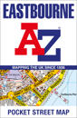
karta, falsad., 2024, Engelska, ISBN 9780008657444
Navigate your way around Eastbourne with detailed street maps from A-Z This up-to-date, folded A-Z street map indexes more than 2,000 streets in and around Cardiff. As …
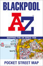
karta, falsad., 2024, Engelska, ISBN 9780008657369
Navigate your way around Blackpool with detailed street maps from A-Z. This up-to-date, folded A-Z street map includes all of the 2,100 streets in and around Blackpool. …