The Reeds Looseleaf Almanac provides all the information required to navigate Atlantic coastal waters around the UK, Ireland, Channel Islands, and the entire European coastline …
The Reeds Looseleaf Update Pack provides all the information required to navigate Atlantic coastal waters around the UK, Ireland, Channel Islands, and the entire European coastline …
All the information a practitioner might need on indirect tax is set out in De Voil. As well as VAT, De Voil covers Customs Duties, Insurance Premium Tax, Air Passenger Duty, …
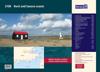
This fully revised and extended edition of our popular 2300 Dorset and Devon Coasts chart pack has been redesigned and expanded to 13 sheets and includes improved coastal coverage …
This service provides two looseleaf volumes containing commentary, forms, precedents, new developments and British Company Cases, plus a fortnightly newsletter. It gives lawyers, …
The Reeds Looseleaf Almanac provides all the information required to navigate Atlantic coastal waters around the UK, Ireland, Channel Islands, and the entire European coastline …