This fully updated 6th edition has had a complete facelift and is now published in full colour in a new format. Throughout, the work has been updated, and in places expanded. It …
This new eleventh edition has numerous updates throughout, with contact details, plans and text undergoing a thorough revision. Care has been taken to research the details of …
The twelth edition of this renamed popular title covers Ibiza, Formentera, Mallorca, Cabrera and Menorca. The only fully comprehensive pilot guide to the Spanish islands in …
From Ouessant in the north to Hendaye on the Spanish border, the third edition of this comprehensive sailing guide to the Atlantic coast of France has, once again, been thoroughly …
The ninth edition of Inland Waterways of France is the ideal guide for planning cruises in and through the most fascinating and diverse waterway network in Europe. This edition …
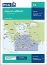
Imray-Tetra charts for the Ionian and Aegean are widely acknowledged as the best available for the cruising sailor. They combine the latest official survey data with first-hand …
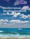
'Mediterranean Weather Handbook for Sailors' is an indispensable reference providing a general understanding of the various phenomena concurring to determine weather in the …
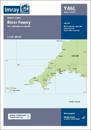
Plan included Continuation to Lostwithiel (1:20 000) Part of the small format Y series (A2 size), this replicates sheet 2400.7 from the 2400 West Country Chart Pack
Double -sided. Side one- Europe from Ireland and Portugal to the Caspian Sea - dimensions 1210 x 870 mm. Scale 1:4 000 000- enlargement on reverse, with unprecedented detail, …