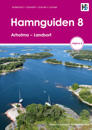
Den här boken beskriver 400 natur- och gästhamnar från Arholma till Landsort. Varje hamn presenteras med en detaljerad Hamnguidekarta, en helikopterbild, en beskrivande text och en …
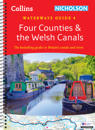
The bestselling guides to Britain’s canals and rivers for over 50 years. This established, popular and practical guide covers the canals and waterways in Wales and to the …
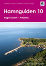
Den här Hamnguiden beskriver 206 natur-, klubb- och gästhamnar från Höga kusten i norr till Arholma i söder. Här beskrivs kända och mindre kända naturhamnar, här ges tips om leder, …
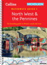
The bestselling guides to Britain’s canals and rivers for over 50 years. This established, popular and practical guide covers the canals and waterways in the north west …
This seventh edition has been revised with new photos, updated technical and local information, and covers 60 miles of navigable waterways, including the tidal section to Kings …
This relatively remote cruising area at the edge of the North Sea has much to offer small and shoal-draught boats that will take the ground, but skippers of larger, deeper keeled …
This fully revised and extended edition of our popular 2300 Dorset and Devon Coasts chart pack has been redesigned and expanded to 13 sheets and includes improved coastal coverage …
This fully revised edition of our popular 3200 Islas Baleares chart pack consists of 25 sheets. It includes the latest official Instituto Hidrografico de la Marina data, combined …
The atlas contains 12 sheets- 2600.1 Trevose Head to St David's Head 1:450, 000 WGS 84 2600.2 Padstow to Hartland Point 1:120, 000 WGS 84 Plans Approaches to Padstow, Bude Haven …
While traditional navigation has been largely superseded by GPS, traditional navigation remains a valuable skill, an enjoyable pastime and necessary for some navigation and …