Båtsporter
Filter
On this 2018 edition the chart specification has been improved to show coloured light flashes. Depths have been updated from the latest surveys and the completed works on the …
Greek Dodecanese islands and the Turkish coast from the Samos Strait as far east as Kas and Kekova
At a scale of 1:7,620,000 this chart covers the North Atlantic from Brazil to Newfoundland and Gibraltar to the Caribbean. It has been constructed on a conical projection that …
Baie de Morlaix to L'Aber-Ildut
For this 2022 edition the chart has been fully updated throughout with revised depths and the latest wind farm developments.
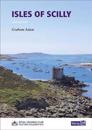
The Royal Cruising Club Pilotage Foundation�s guide is a must for anyone planning an extended visit to this beautiful archipelago on the edge of the Atlantic.
A pack of 10 charts for the Suffolk and Essex Coasts. The latest depth surveys have been applied. The latest wind farm information is included where relevant. There has been …
For this 2022 edition the chart has been fully updated throughout with revised depths.
Plans included: Tyrrel Bay (Carriacou) (1:17 500) Grenada Bay (1:30 000) Grenville Harbour (1:15 000) Grenada - Southeast Coast (1:45 000) Grenada - South Coast (1:40 000) Saint …
Plans included:Sligo Harbour (1:70 000)Broad Haven Bay (1:75 000)Portnafrankagh (Frenchport) (1:25 000)Achill Sound (1:70 000)Approaches to Westport (1:45 000)Bofin Harbour …