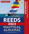
The Reeds Looseleaf Almanac provides all the information required to navigate Atlantic coastal waters around the UK, Ireland, Channel Islands, and the entire European coastline …
The Reeds Looseleaf Update Pack provides all the information required to navigate Atlantic coastal waters around the UK, Ireland, Channel Islands, and the entire European coastline …
This fully revised and extended edition of our popular 2300 Dorset and Devon Coasts chart pack has been redesigned and expanded to 13 sheets and includes improved coastal coverage …
The Reeds Looseleaf Almanac provides all the information required to navigate Atlantic coastal waters around the UK, Ireland, Channel Islands, and the entire European coastline …
The Reeds Looseleaf Update Pack provides all the information required to navigate Atlantic coastal waters around the UK, Ireland, Channel Islands, and the entire European coastline …
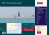
This complete redesign of our 2800 Kintyre to Ardnamurchan chart pack now includes more detailed coverage of the area and comes as a paper and digital edition.