Plan included Continuation to Lostwithiel (1:20 000) Part of the small format Y series (A2 size), this replicates sheet 2400.7 from the 2400 West Country Chart Pack
2400.1 Land's End to Trevose Head 1: 180 000 WGS 84 Includes plans Newquay Bay (1:10 000) and Saint Ives (1:15 000) 2400.2 Approaches to the Isles of Scilly 1: 120 000 WGS 84 …
This map of mainland Britain that shows the huge extent of paddling possibilities on rivers, lochs, canals and coast - some 37,000km of paddling! Enthusiasts buy this map to plan …
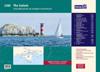
A convenient A2 format chart pack of The Solent and Isle of Wight provided in a sturdy plastic wallet. This fully revised and extended edition of our popular 2200 The Solent chart …