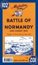
Michelin Battle of Normandy Map 102 covers the region associated with the Battle of Normandy between June and August 1944, at a scale of 1:200,000. Historic WWII reproduction map. …
In French and in English, one side shows the position of the different armies and the progression of the Battle of Normandy. The other side features a photograph which shows the …
A superb map of the progress of the front line in Normandy from the initial landings in June 1944 through to August 24, 1944. The locations and movements of all the allied units …
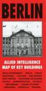
Published specially by After the Battle to coincide with the suspension of Allied occupation rights in Berlin in October 1990, this map was produced in 1944 by the War Office and …
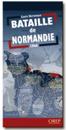
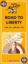
Michelin's Road to liberty Map 105 covers the region associated with France's liberation between June 1944 and January 1945, at a scale of 1:500,000. This is a reprint of the 1947 …