On this edition the magnetic variation curves have been updated with 2020 data. Under new royalty terms, the DGA (Danish Geodata Agency) have made it unviable to reproduce their …
On this edition the chart specification has been improved to show coloured light flashes. The harbour plans of Puerto de San Sebastian de la Gomera and Puerto de NaosLos Marmoles …
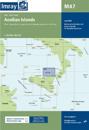
Plans included:Ayvalik (1:75 000)Sigri (N. Lesvos) (1:30 000)Entrance to Kolpos Kalloni (N. Lesvos) (1:30 000)Entrance to Kolpos Yeras (N. Lesvos) (1:40 000)Mitilini (N. Lesvos) …
Plans included:Approaches to Lipari (1:25 000)Bocche di Vulcano (1:45 000)Approaches to Milazzo (1:30 000)On this 2018 edition a new plan showing the approaches to Milazzo is …
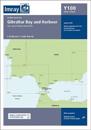
A brand new chart for 2020 covering Gibraltar BayHarbour. This chart is a replica of the Gibraltar sheet found in the Imray chart atlas 3210 Gibraltar to Cabo de la Nao. It is …
On this edition the chart specification has been improved to show coloured light flashes. Completed harbour works are included on the plan of the approaches to Istanbul. There has …
This popular map of the non-tidal Thames from its the source above Cricklade to the entrance of the Grand Union Canal at Brentford below Teddington Locks is convenient in any …