Filter
- Historical images ltd (10)
- Alan godfrey maps (34)
- The historic towns trust (10)
- Blue crow media (5)
- Cassini publishing ltd (4)
- Harpercollins publishers (3)
- Herb lester associates ltd (3)
- Aventuras literarias s.l. (2)
- Ordnance survey (2)
- Bodleian library (1)
- Carta,the israel map publishing company ltd,israel (1)
- Pitkin publishing (1)
- Royal commission on the ancient historical monuments of scotland (1)
- University of nebraska press (1)
- Waverley books (1)
Historie og arkeologi
Filter
-

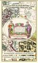
Oxfordshire 1611 - 1836 - Fold Up Map that features a collection of Four Historic Maps, John Speed's County Map 1611, Johan Blaeu's County Map of 1648, Thomas Moules County Map of 1836 and a Plan of Oxford 1836 by Thomas Moule. The maps also feature a number of Oxfords famous historic buildings.
av Mapseeker Publishing Ltd.