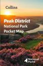
Handy little full colour map of Peak District National Park. Detailed mapping and visitor information to the National Park along with a selection of photographs. Map at …
OS Explorer is the Ordnance Survey's most detailed map and is recommended for anyone enjoying outdoor activities such as walking, horse riding and off-road cycling. The series …
HARVEY launch innovative new series: Ultramap XT40. 16 titles featuring in Trail magazine through spring 2016. 40 years experience have gone into HARVEY's most creative new series. …
Rides using Trans Pennine Trail, Pennine Bridleway and featuring a 110 mile 'Pike to Peak' circular route, linking the famous landmarks of Stoodley Pike near Hebden Bridge to …
The maps are all produced at a scale of 1:100 000 showing important features including the National cycle Network. Sections on road, off road and traffic free are all shown in …