Includes the whole of the Killarney National Park. Detailed map for hillwalkers of MacGillycuddy's Reeks at 1:30,000 scale. Summit enlargement of Carrauntoohil at 1:15,000. Shows …
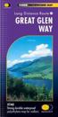
The HARVEY series of Long Distance Route maps have long been a success. Now we have applied the advanced technology used in the creation of last years best selling British Mountain …
XT40 - A new generation of tough polyethylene maps. These maps are a leap forward in technical excellence. Tough, durable and 100% waterproof they are compact - not the great bulky …
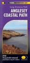
The 200km (125 mile) long Anglesey Coastal Path is a long distance route that follows much of the island's coastline and comprises one section of the Wales Coast Path. The path …
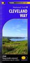
Cleveland Way National Trail was the second to be established in Britain and is now over 40 years old. Many walkers consider it to be a classic route because of the variety of …
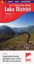
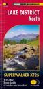
New Superwalker XT25 of the Lake District. Revised and re-designed It's got everything! Genuine original HARVEY mapping at 1:25,000. Clear, easy to read. Easy to re-fold. Opens …
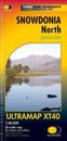
HARVEY launch innovative new series: Ultramap XT40. 16 titles featuring in Trail magazine through spring 2016. 40 years experience have gone into HARVEY's most creative new series. …
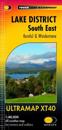
Covers a large area yet is handily compact. Pocket perfect! Detailed map for runners and walkers of the south eastern fells of the Lake District National Park at the magic scale of …